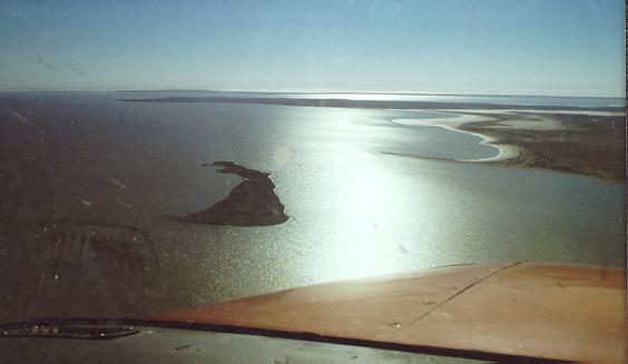
"Grand canyons, rampant headlands, beautiful bays, spangling spits and idyllic islands"
|
Behind the Names
"Grand canyons, rampant headlands, beautiful bays, spangling spits and idyllic islands" |
Notes:
Outsiders may laugh at the use of the word "canyon" when naming features around the Lake that are below sea level. However on experiencing the optical illusion of exaggerated height and distance in flat desert country the observer will agree that these gullies do, in fact, appear as grand as the world's best known canyon.
| Legend: | Official Place Names approved and used on Government maps. |
| Unofficial names used by locals, created by the Dulhuntys and published by them or named by other early navigators. | |
| Unofficial names created by LEYC members to aid location identification. | |
| ABC Bay | Named after the ABC film crew that camped there in 1976. |
| Ankle Point | See Fossil Tree Head |
| Annabel Island | Annabel Douglas-Hill camped there with Bob Mossel 22/6/1974 during an expedition up Cooper Creek. Located in the Goyder Channel and over which the causeway to the Lake Eyre Lease is constructed. |
| Artemia Point | Named for brine shrimp collected there by C W Bonython in 1953 |
| Babbage Peninisula | Named after B H Babbage who discovered Lake Eyre (North) as a distinct entity from Lake Eyre (South) in November 1858. |
| Bando Hill | Origin of this hill on the west coast of LEN is unknown. |
| Barrier Islands | A chain of islands representing a challenge to navigation between Emeroo and Pelican Points in Lake Eyre South. |
| Belt Bay | E F Belt was the first to traverse its shores in 1877-8 |
| Big Beach | Located on the western tip of Babbage Peninsula |
| Big Camel Canyon | Named by the Dulhuntys after they observed a Camel while in the Canyon. |
| Bluebird Island | Named after Don Campbells vehicle the Bluebird in which he broke the world land speed record of 403.1mph in 1964 |
| Bonython Headland | C W Bonython (Bon-eye-thon) took a leading part in the scientific exploration of Lake Eyre during 1950-63. |
| Boundary Bay | Named due to its proximity to the boundary of the Eliot Price Conservation Reserve. |
| Breakthrough Gully Breakthrough Canyon |
This canyon when filled in the 1974 flood enabled John and Roma Dulhunty to bypass the Hunt Peninsula by boating from Madigan Gulf through the canyon and dragging their boat across the 50 metre gap to Jackboot Bay. The Place Names Committee changed the name to "Gully" as they had never been there. Anyone who has seen it knows it is a canyon. |
| Brooks Island | Named after Malcom Brooks who, with Eliot Price and "Blue" Hughes, was shipwrecked on the Island in 1950. |
| Campbell Point | Named after Donald Campbell who broke the land speed record near the point in 1963-64 |
| Campbells Causeway | Named after Don Campbell this causeway was created to enable service vehicles to cross the soft edge of the Lake during his world speed record attempts in 1963-4. Located on the northwest tip of Prescott Point it was washed away in the 1974 flood. |
| Canyon Head | Named by the Dulhuntys and near Little Camel Canyon |
| Cliff Head | Named by the Dulhuntys at the SE shore of Madigan Gulf |
| Cooper Creek | Entering the west side of LEN "The Cooper" was named by Charles Sturt after Justice Sir Charles Cooper in 1845. |
| Cooper Groove | The groove in the northern alluvial fan created by flood waters from the Cooper Creek. |
| Dingo Soakage | A low lying swampy location near Prominent Hill, southern Belt Bay. |
| Dulhunty Island | Named after Dr John Dulhunty who surveyed and researched the Lake in the 1970's. |
| Emeroo Point | Aboriginal name possibly suggesting its resemblance to a roo tail. |
| Eric Island | Named after Eric G Bonython following his boat trip with Hector Brooks to the Mouth of The Cooper in 1950 |
| Eyre Lookout | The hill from which Edward John Eyre first looked over Lake Eyre (South) in 1840-41. |
| Fossil Beach | Located in Lake Eyre South and named for the Protobelis fossils found there. |
| Fossil Tree Head | Named by the Dulhuntys after they observed the numerous fossillized tree roots located there. |
| Goyder Channel | The channel connecting Lake Eyre North and South. Named after Surveyor-General George Woodroffe Goyder. |
| Halligan Bay | E F Halligan was the first man to be flown over the Lake in March 1922. |
| Hambidge Point | C W Hambibge initiated a study of the 1945/50 flooding of Lake Eyre. |
| Hector Island | Hector G Brooks navigated the lower part of the flooded cooper creek into Lake Eyre with G Bonython in August 1950. |
| Hughes Island | Named after "Blue" Hughes from Muloorina. The name was not approved in 1979 as Mr Hughes was still alive! |
| Hunt Peninsula | G W Hunt traversed and mapped the peninsula in 1897. |
| Ibis Island | Named by Alvin and Max Atkinson and Robert Clark who discovered the island during their epic adventure on the yacht Ibis in mid 1975. |
| Jackboot Bay | Named by C W Bonython because its shape resembles a Jackboot. |
| Jackboot Channel | The water scoured channel that lies alongside The Sandspit at the entrance to Jackboot Bay. |
| Kalaweerina Groove | The groove in the northern alluvial fan created by flood waters from the Kalaweerina Creek, a distributary of The Warburton. |
| Kunoth Shoal | A shoal in Madigan Gulf that is free of salt when dry. Named after C Kunoth who crossed it in 1929 with C T Madigan. |
| Lake Clayton | The Lake at the inlet of the Frome and Clayton rivers. |
| Lake Eyre | Officially named after Edward John Eyre who was the first european to sight the Lake while exploring the area around the Northern Flinders in 1840-41. He incorrectly reasoned that the lakes from Torrens around to Frome were one large horseshoe lake. Originally named Lake Gregory by Babbage the first European to recognize Lake Eyre as being seperate from Lake Torrens. |
| Late Lunch Island | After a long morning in October 1997 attempting to make Pelican Point on LES this island at the northern end of the Barrier Islands provide a panoramic location in which to partake lunch. |
| Level Post Bay | Named by C W Bonython after the Level Post that he placed there. Used by the Dulhuntys as a reference when suryeying the Lake in the early 1970's until it was washed away in the 1975 flood. |
| Lewis Bay | The NW corner of LEN. J W Lewis explored and surveyed the Lake in 1874-5. |
| Little Camel Canyon | Named by the Dulhuntys (see Big Camel Canyon). |
| Macumba River | Joins The Warburton just prior to entering LEN. Discovered by Stephen Jarvis about 1862. Aboriginal for "big (mucka) fire (umba)". |
| McLachlan Springs | Just south of LES. Named by Goyder in 1860 after a member of his party. |
| Madigan Gulf | Named by C W Bonython after Cecil B Madigan who flew over the Lake in 1929 and who also walked the East side in 1939. |
| Middle East Spit | Located on the east side of the "ankle" of Jackboot Bay. |
| Middle West Spit | Located on the west side of the "ankle" of Jackboot Bay. |
| Midway Point | Named by the Dulhuntys it is on the Hunt Peninsula |
| Neales, The | A tributary of LEN named by Stuart on June 6 1859 after J B Neales MLA.. |
| Northwest Head | Named by the Dulhuntys and now more commonly known as ABC point. |
| Peak Jones Point | Mr K Peake-Jones took part in investigations of Lake Eyre during 1950-56 on behalf of the Royal Geographical Society. |
| Pelican Point | Below Eyre Lookout on LES. |
| Picanniny Island | Found and named by the Dulhuntys, this island is submerged at approximately 2m. |
| Prescott Point | Professor J A Prescott accompanied Madigan in 1929. Named by C W Bonython. |
| Price Peninsula | Named after Eliot Price the former owner of Muloorina Station |
| Price Point | Named after Eliot Price the former owner of Muloorina Station. Located on the western side of the Frome Entrance. |
| Prominent Hill | The most prominent feature in southern Belt Bay |
| Shelly Island | Southern Madigan Gulf |
| Silcrete Channel | The channel between Silcrete Island and the mainland. Possibly the deepest part of the Lake due to the scouring action of strong currents. |
| Silcrete Island | Name was submitted by W M Rice, who was preparing an article on South Australian salt lakes for acceptance and publication by the National Geographical Society. Name was originally proposed by Mrs Roma Dulhunty in her book " The Spell of Lake Eyre"-she writes "it had that shadowed, sullen look of juri-crust, which it was, and so we named it silcrete island". The island was mentioned by Atkinson and Clark in an article "Ibis cruises Lake Eyre", published 29/10/1975. |
| Snake Gully Camp | Obviously named as such by John Dulhunty |
| Soft Bluff | Located between the Silcrete Sandspit and Big Camel Canyon this imposing bluff of light color is a beacon to navigation. The bluff comprises soft gypsous material. |
| Swan Island | Located near Emeroo Point on LES. |
| The Atolls | A collection of butes on the western shore of Madigan Gulf |
| The Sentinel | Guards the entrance to Little Camel Canyon |
| The Warburton Groove | The groove in the northern alluvial fan created by flood waters from The Warburton. It extends as far as Dulhunty Island. |
| View Point | Named by LEYC as the best spot for observing conditions on Lake Eyre South. |
| Warburton River (The Warburton) | Named by George Woodroffe Goyder on 02-08-1866 after Major Peter Egerton Warburton an early explorer of the area. The river's original (historical) name was The Warburton and it is still used by those with an association with the river. Warburton Creek is an unapproved alternative name normally used by poor map makers who have not checked the latest 1:250k AUSLIG maps of the area. They obviously haven't seen the river! |
| Warriner Creek | Named by Babbage in 1858 after Thomas Warriner a member of his party. |
| Williams Point | Immediately southeast of Shelly Island. Named in honour of Dr Williams research work in the Lake Eyre region. Name approved as a recorded name by Geological Names Advisory Committee on 3/8/1993. |
| Willow Bay | Named by Dulhuntys for the Willows that grow there. |
| Willow Head | Named by Dulhuntys for the Willows that grow there. |